Prehistoric
Bardsey-cum-Rigton is a place of special character and historic interest. There is evidence of extensive activity during the Late Iron Age and Romano-British period. Crop marks show archaeological remains of enclosures, fields and track ways. There is some evidence of an earlier Bronze Age burial barrow to the east of East Rigton Farm. There are some low ridge earthwork marks to the north of East Rigton suggesting the probable line of a Roman Road.
Early Medieval and Domesday Berdesei
Bardsey as we know it today has Anglo-Saxon origins. All Hallows Church includes elements dating between 850-950AD. Originally a two- cell building with the west tower being built as a porch. The nave also dates from this period and includes evidence of the original roofline and a blocked window. The church was not mentioned in the Domesday Book in 1086 but a priest is recorded as living in East Rigton and probably served Bardsey.
The Bingley Arms is featured in the Guinness Book of Records as the oldest inn in England and cites a 10th century date of origin.
At this time the settlement was recorded as Berdesei and was owned by the King. This place name is derived from Old English elements meaning island-like hill, enclosure or high place hill. Bardsey Hill is the most likely area to fit this description.
Medieval Bardsey
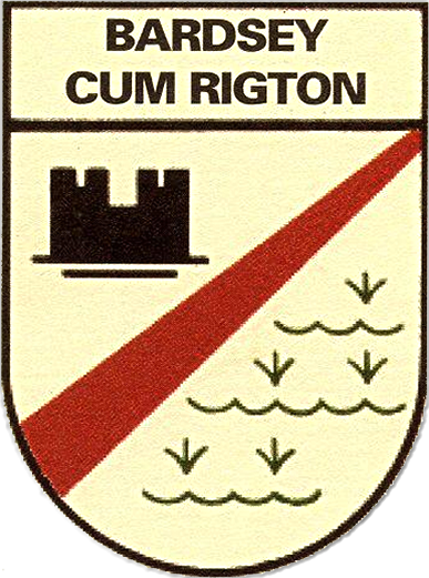
The remains of a 12th century motte and bailey castle survive to the north of the church at Castle Hill. Thought to have been constructed by Adam de Bruce, a North Yorkshire baron who was granted the manor of Bardsey shortly after 1175 as part compensation for the loss of his estates around Danby.
The motte is situated at the centre of a flat oval bailey which would have been surrounded by a wall or timber palisade. The motte is unusual as it is a large elongated platform 1-2m high, c100m long by c30m wide. A wide ditch with a central causeway cuts across the centre of the length of the platform dividing the site into two parts. Archaeological excavations in the late 19th century and again in 1930 on the eastern enclosure revealed the remains of a substantial stone tower. The pottery assemblage recovered during excavations suggest that the castle was only occupied from c1175 to c1200. The site has now reverted to agricultural use and is privately owned.
In 1201 the lands and manor of Bardsey reverted to crown ownership and in c1205 it was granted to Kirkstall Abbey and remained in their ownership until the dissolution of 1539.
A document 0f 1209 records that the Abbey held 400 sheep on their estate at Bardsey and Collingham. At this time the Abbey was a leading wool producer running their estate from a ‘Grange’ headquarters. There is no evidence to suggest that Bardsey Grange or Rowley Grange are the monastic establishment. Bardsey Grange is dated 1717 but possibly incorporates an earlier 17th century inner core where William Congreve, the restoration playwright was born in 1670.
All Hallows church was significantly altered during the Norman period; the north aisle was constructed c1100-1125 and the south aisle c1175-1200. The elaborately carved southern doorway with its distinctive chevron moulding and beakhead ornament also dates to this period. In the early 14th century the Norman aisles were widened and the chancel was rebuilt. Other medieval survivals include the group of six cross slab grave covers all dating between the 11th and 13th centuries.
Survey of the Manor – 1735
This depicts All Hallows church in Bardsey with a number of properties now built along Church Lane and a cluster of dwellings around the junction of Smithy Lane. Bardsey Grange is shown to the north of Castle Hill and the corn mill is depicted on the stream to the east.Two significant buildings are omitted from the Manor Survey as they did not form part of the manor. These are The Bingley Arms (and land to the south) and Callister Hall, a school house built in 1726. However, at this time East Rigton had a more nucleated settlement based around the large open green with a pattern of croft and toft plots illustrating its agricultural character. The layout of these dwellings probably dates from the medieval strip field system that is known to have existed here and suggests that East Rigton village was once a larger settlement than it is today.
19th century
A tithe map of 1845 shows a similar development as in 1735 but now includes The Bingley Arms and other farms in the Bardsey Hill area.
In the 1820s the turnpike road we now know as the A58 was built linking the area to Leeds in the south and Wetherby in the north.
The arrival of the railway and Bardsey station in 1877 continued to improve communications, opening up new markets for the local economy and Bardsey soon became a popular location for generally affluent, middle-class families to commute to Leeds but live in the country.
20th century
The village continued to expand in the early part of this century but a major land sale took place in 1921 stimulating a boom in the building of further substantial, detached houses set in sizable gardens. This newly expanded population required additional facilities such as our 20th century Catholic Church and a new Bardsey Primary School replaced the Callister Hall in the early 1950s.
Bardsey lost its railway line, bridge and station in 1964 by the Beeching cuts.
Nowadays the two historic village centres of Bardsey-cum-Rigton are divided by the busy A58 road but retain their strong sense of community with a peaceful, rural, agricultural character despite the many 20th & 21st century developments that have taken place.